The plan for today is quite ambitious. The routes are quite long, and we want to go the seven-kilometer Caminito del Rey trail and visit Ronda. We leave Cordoba already at 8, so we are in El Chorro around 10:30.
Caminito del Rey – practical information
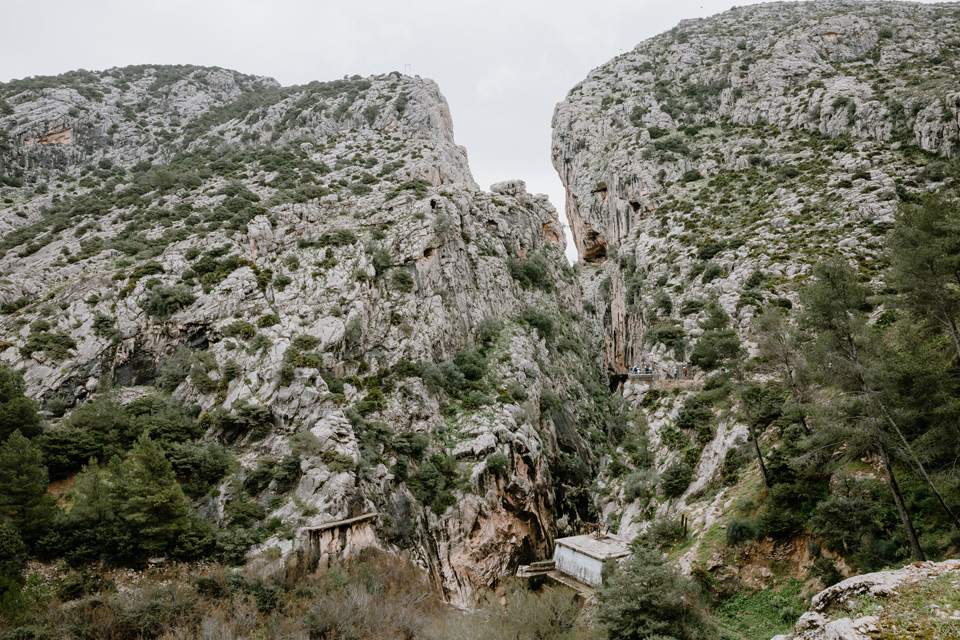
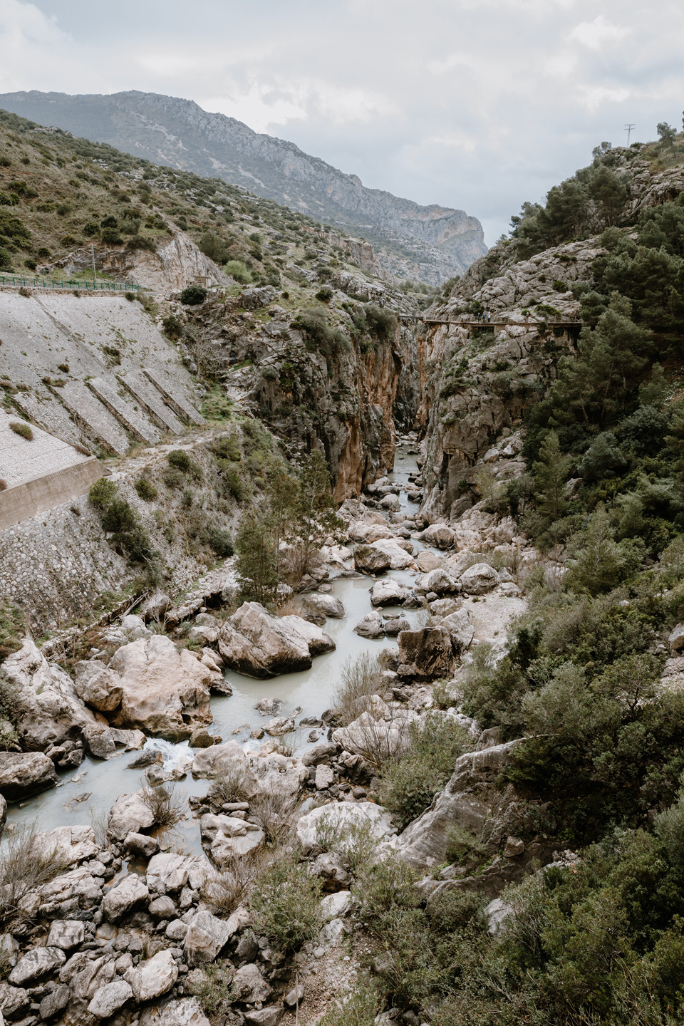
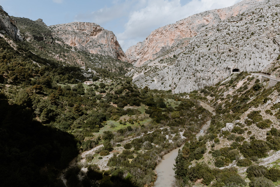
El Chorro is a small town with the end point of the Caminito del Rey route. Caminito del Rey is a walking trail called “King’s Path”. It runs along the steep cliffs of the limestone gorge Desfiladero de los Gaitanes, the bottom of which is the Guadalhorce. The tour of the trail is extraordinary in terms of view and after renovation, visited by many tourists even outside the summer season. A month before departure I had a problem with buying tickets, because on the day I selected there was no option to buy. As a result, I changed the trip plan so that the trail would fall on Thursday – less crowded day than the initially chosen Saturday.
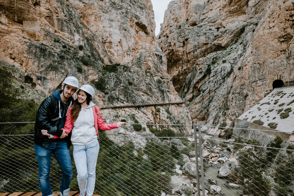
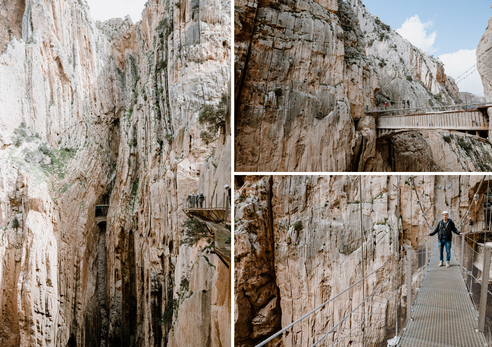
I mentioned that the trail was being renovated. Before renovation, it was considered the most dangerous walking route in the world. There were many fatal accidents here, apparently human remains are still visible today. Today, the route looks very stable, even children would be able to walk there (although admission is only from the age of 8). Each participant must wear a helmet in the event of small stones falling down.
King’s path- Route map
Here I present you a map of the route: map
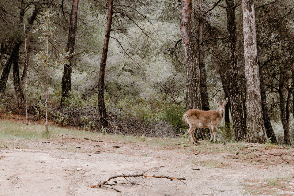
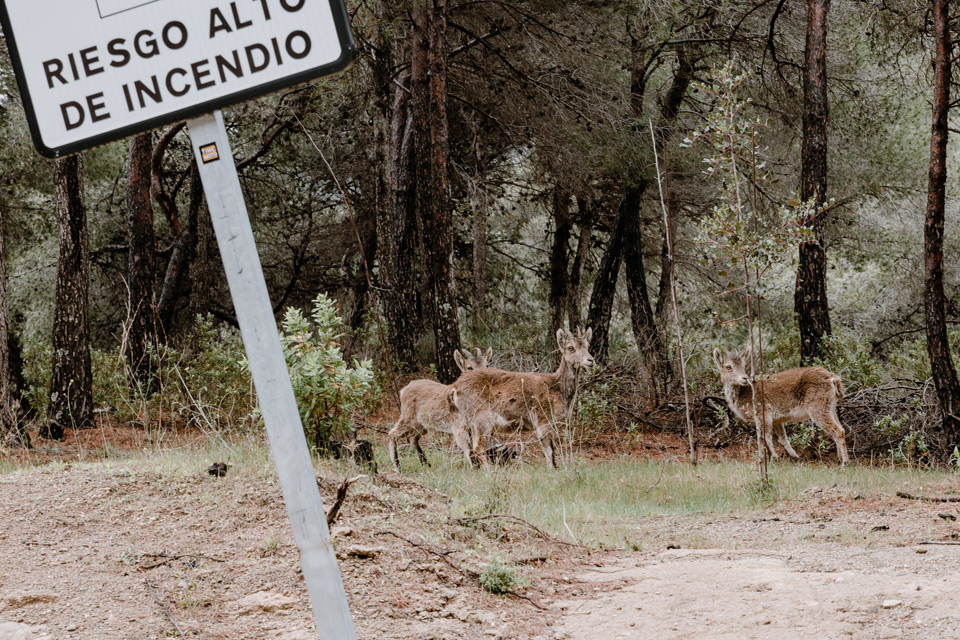
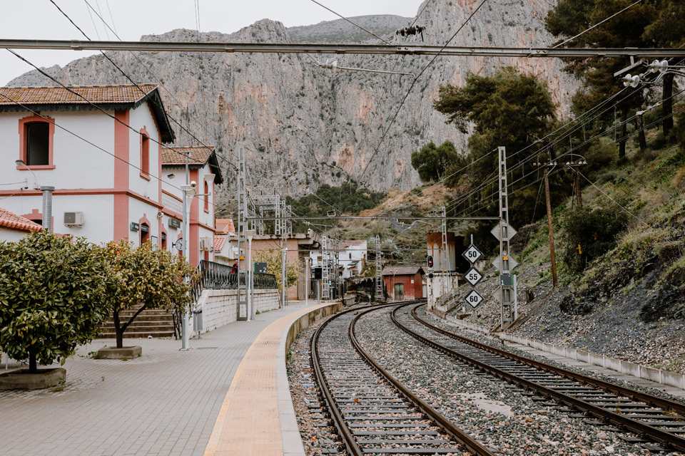
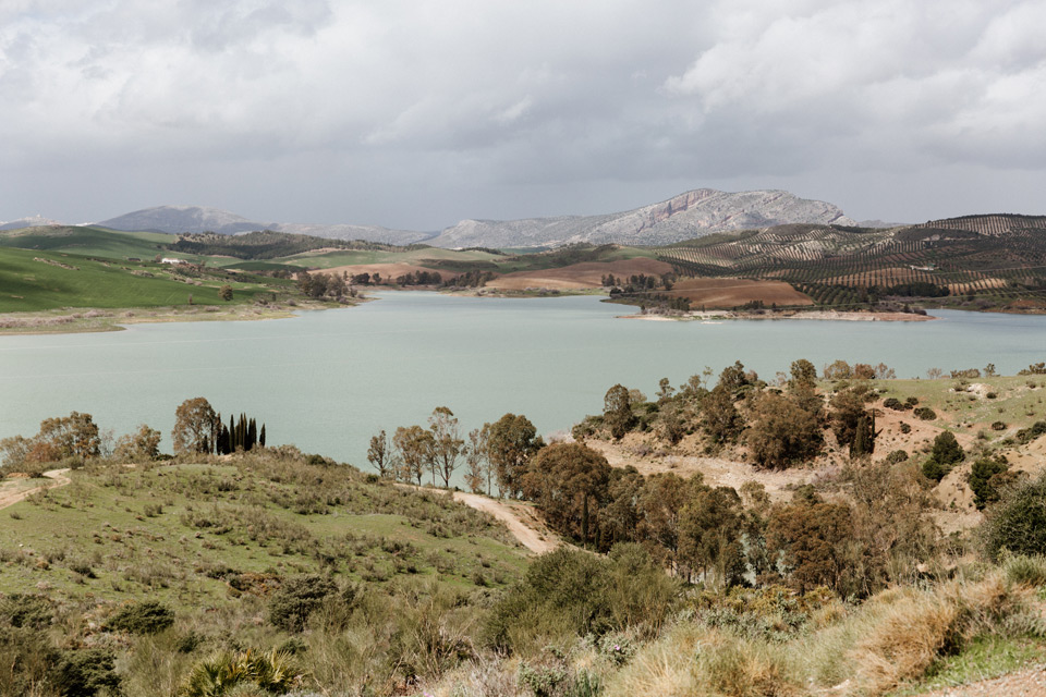
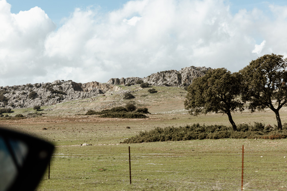
To enter the trail, leave the car at the very entrance in the north or at the exit in El Chorro and take the bus to the entrance. I don’t know which option is better, but we choose the latter. We come to El Chorro and leave the car in the parking lot here. You can also leave your car at the train station itself (here), from where buses departing tourists to the very entrance to the path. They run every half hour, e.g. 10:00, 10:30, 11:00, etc. We get to El Chorro just before the departure of one of the buses, so we approach the train station quite quickly and then get on the vehicle and take narrow roads to north towards Ardales. The road leads mainly through the forest, which is why we see many animals.
El Chorro train station:

Caminito del Rey – road through the forest
The bus takes about 25 minutes. We get off at the bus stop and enter the path. We are here. Going through a tiny tunnel leads us to the forest.
Caminito del Rey – the trail
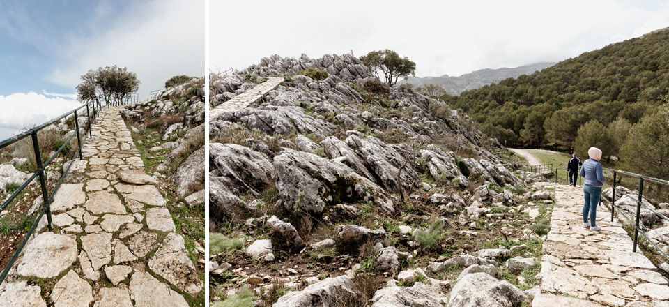
It is 2.6 km of walk to the entrance of the Caminito del Rey trail. At the entrance we a guy printed tickets. After crossing the gate we get helmets and so armed we enter the trail. Thanks to the fact that we have tickets without a guide, everyone can go at their own pace. We paid 10 euros + 1.55 euros for the bus. We booked them on the website: link . The option with a guide costs 18 + 1.55 euros.
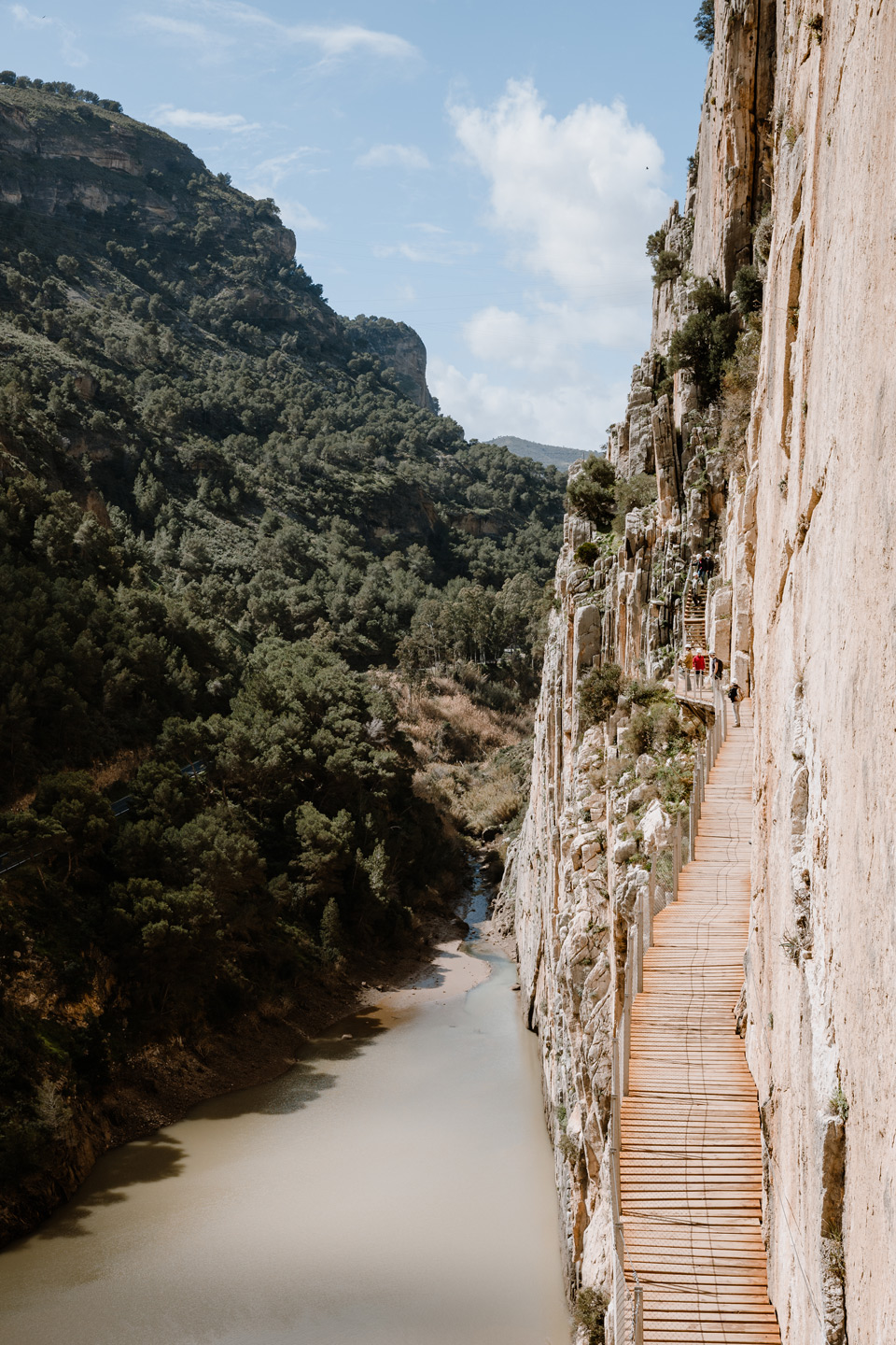
first part of the trail – wooden footbridges
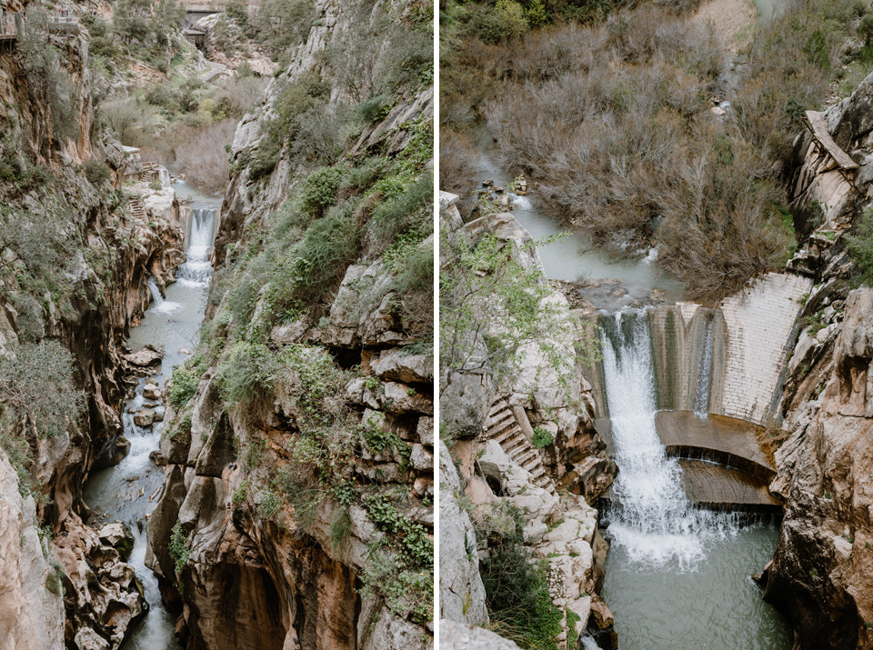
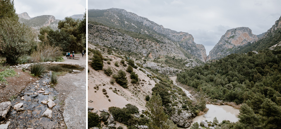
The views are beautiful at the beginning of the route. We photograph, among others, an interesting, small waterfall. 4.5 km of road ahead.
second part of the trail – forest
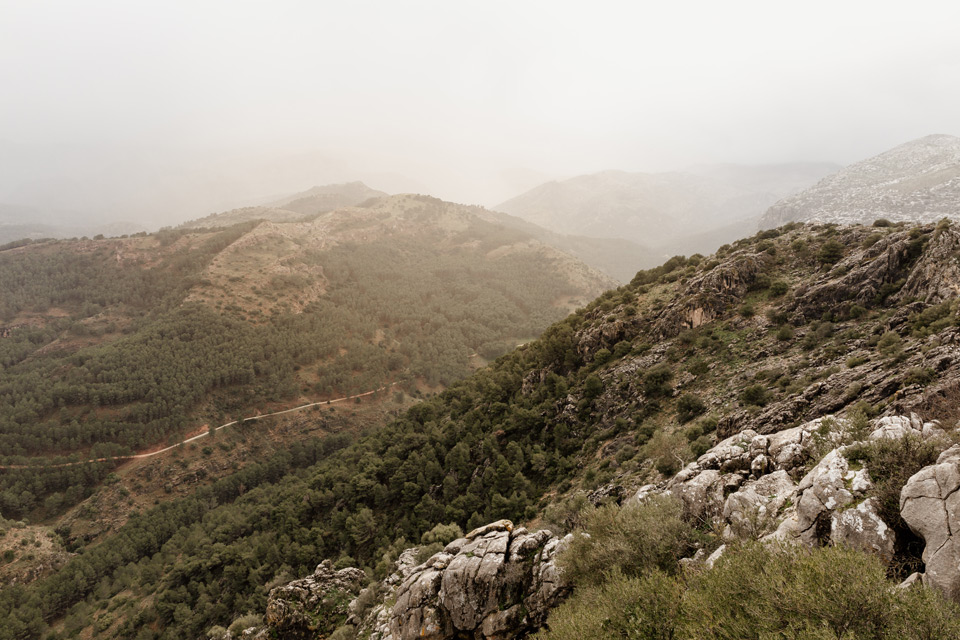
At some point the wooden footbridge ends and we go out onto a gravel road. Part of this route is boring and leads through the forest. I complain and think about how I will go the rest of the trail …

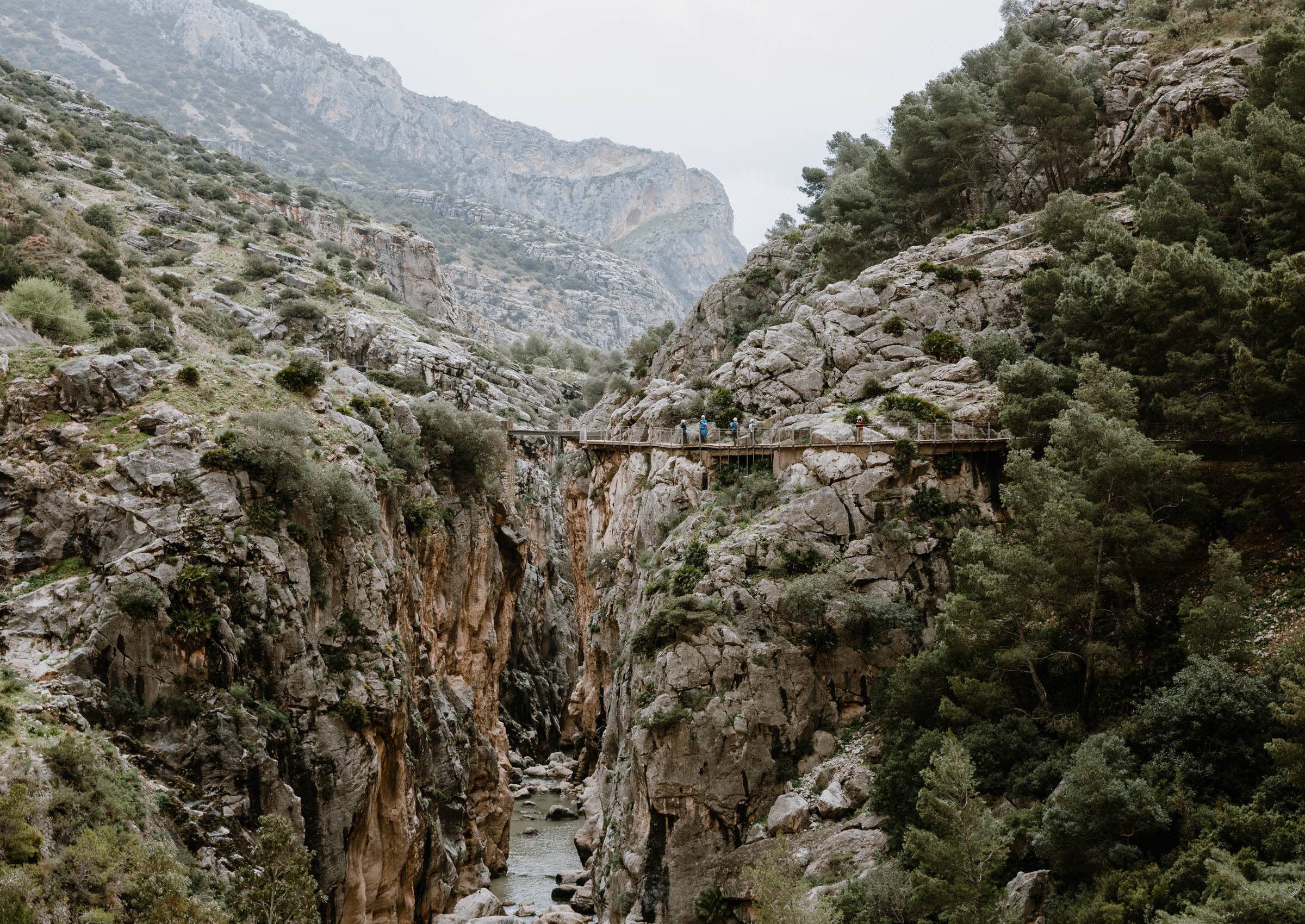
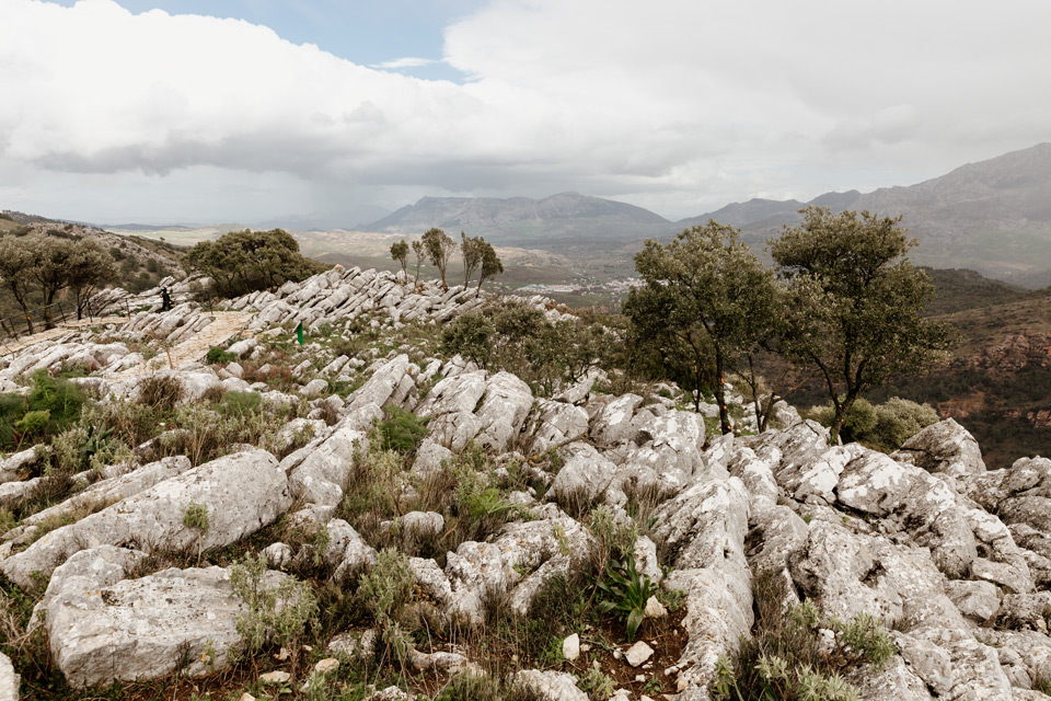
third part of the trail – largest gulfs
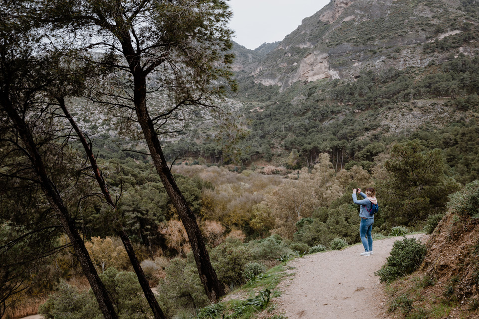
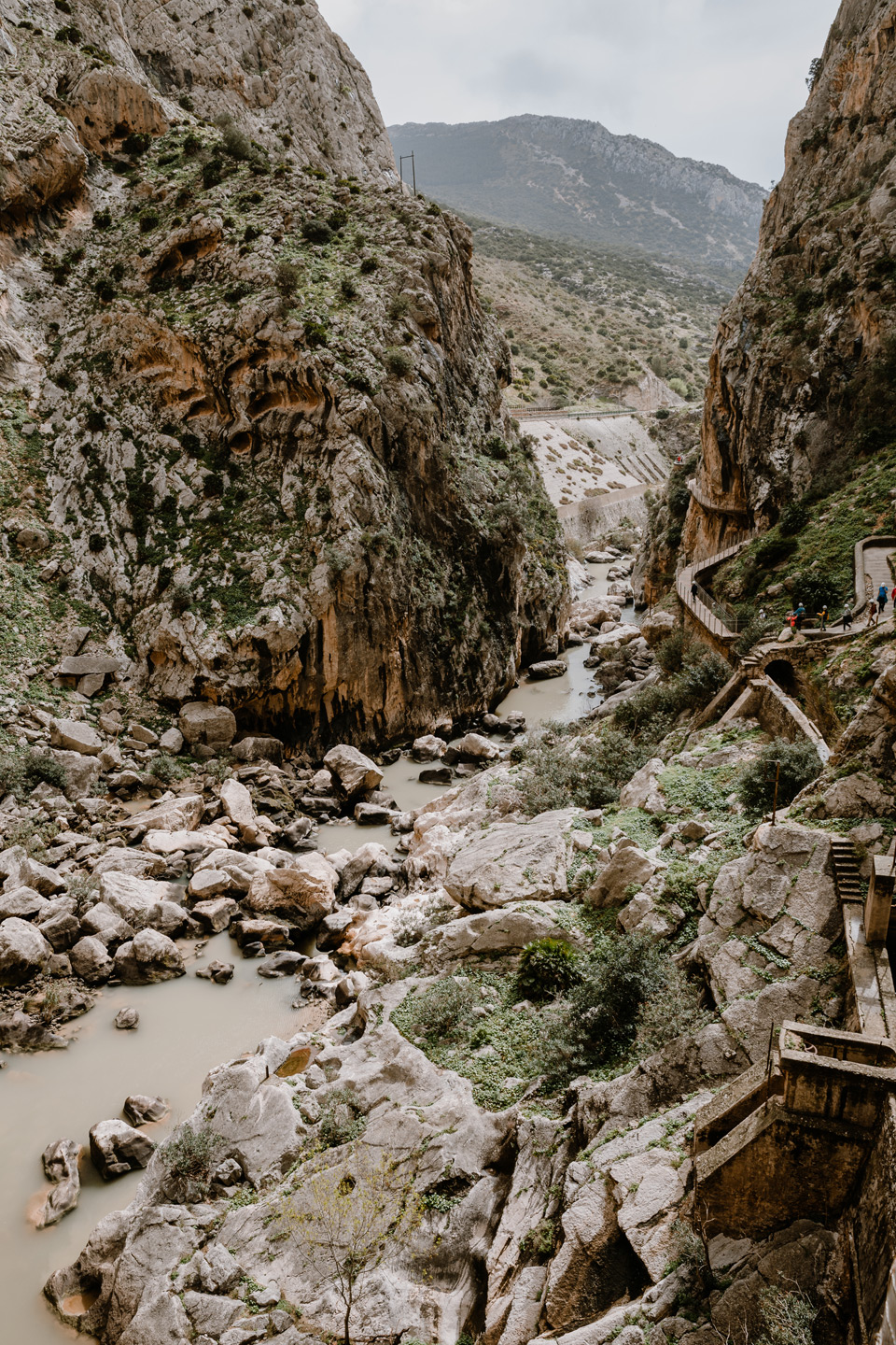
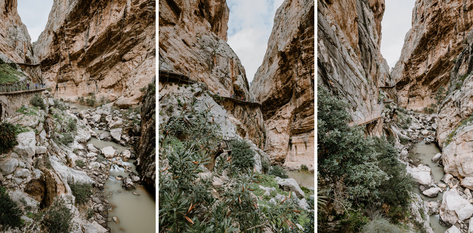
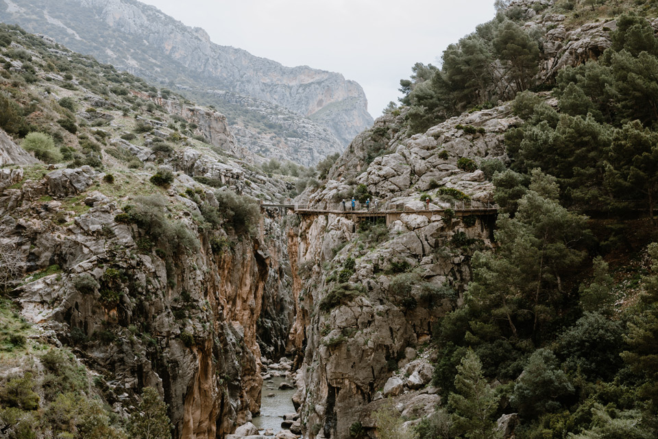
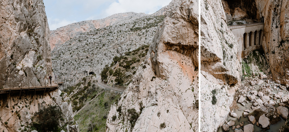
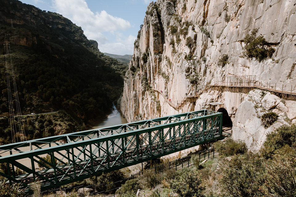
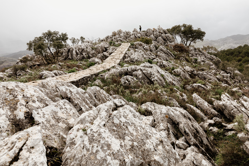
It turns out that after leaving the forest it’s beautiful again. I photograph wonderful mountain landscapes. A bit further, the footbridge begins again and we can admire the large, scenic chasms. We also listen to whether a train is coming – railway tracks are located in the rocks. In some photos you can clearly see the old, dangerous path, which is just below this new one.
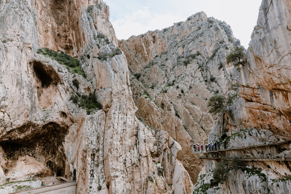
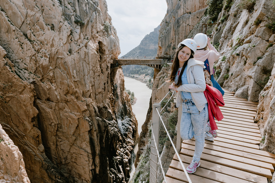
A nice feeling to cross the bridge. A maximum of 10 or maybe 8 people could move on it simultaneously. When you walk on it, it sway slightly and you could feel a bit of adrenaline.


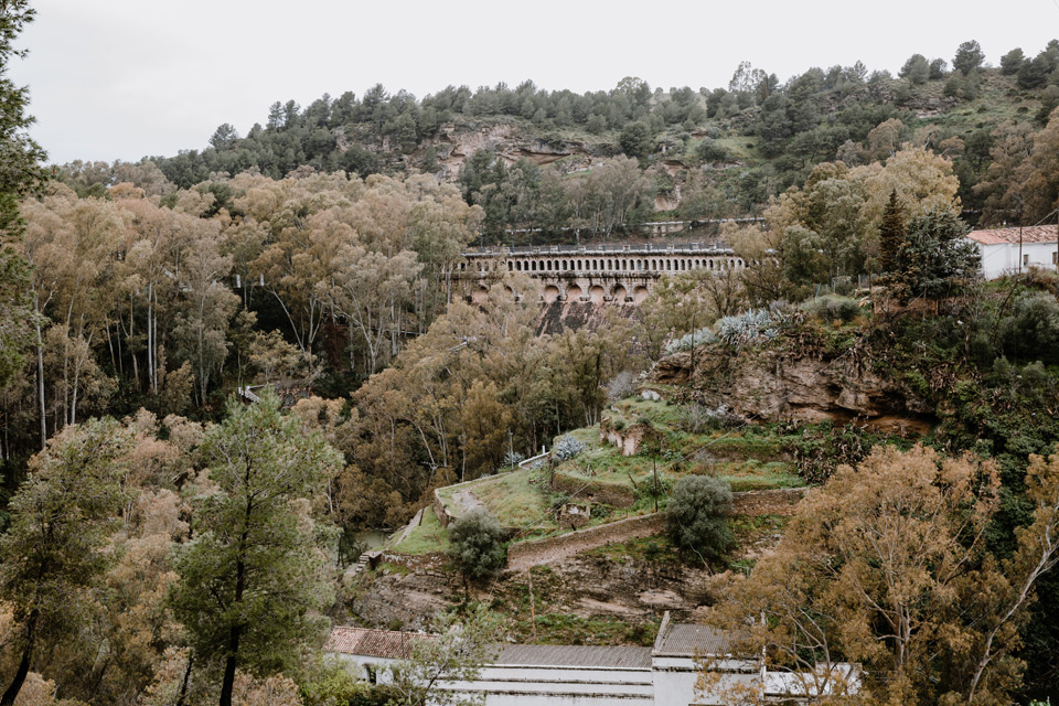
The trail ends next to the green viaduct. It’s quite characteristic, so it is clearly visible from the bus or even from the beginning of the King’s Path.
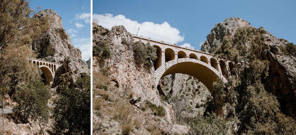
After leaving the trail, an attention is drawn to the old bridge, which blends in nicely with the mountains. Just behind it, there is our parking lot. We refill bottles with water, use the toilet (there are no toilets on the trail) and go as soon as possible to Ronda.

Road to Ronda
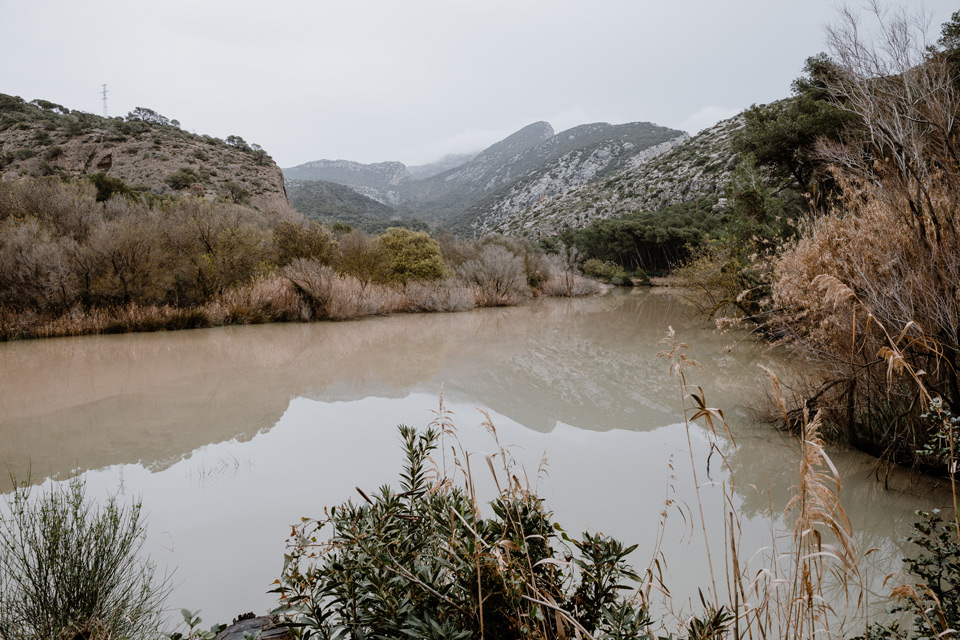
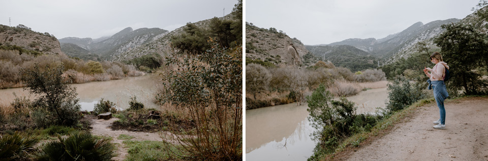
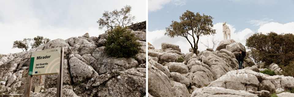
We choose the route leading through the Mirador del Guarda Forestal viewpoint. This route is the shortest in terms of the number of kilometers to cover, but according to Google Maps, it’s half an hour longer than another, only 2 kilometers longer. The road is not the best quality, but fortunately we don’t pass many cars. Most cars follow the second route.
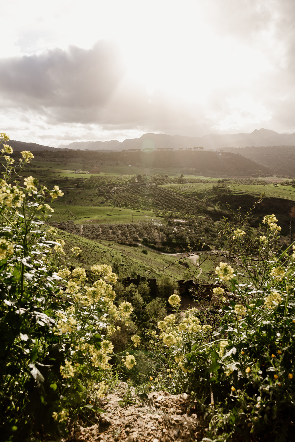
On the way, we observe wonderful landscapes. We stop for a moment to photograph one of them.


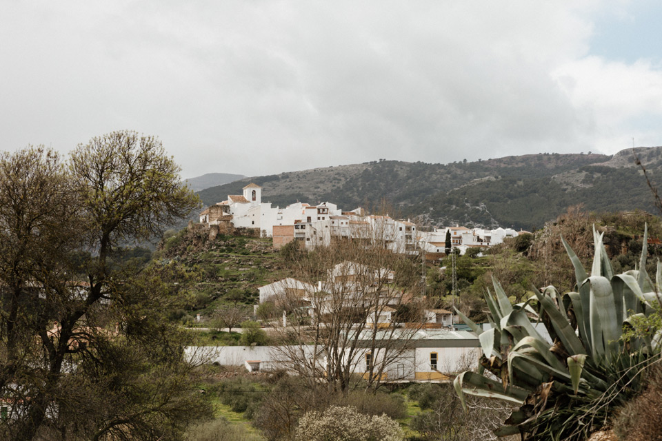
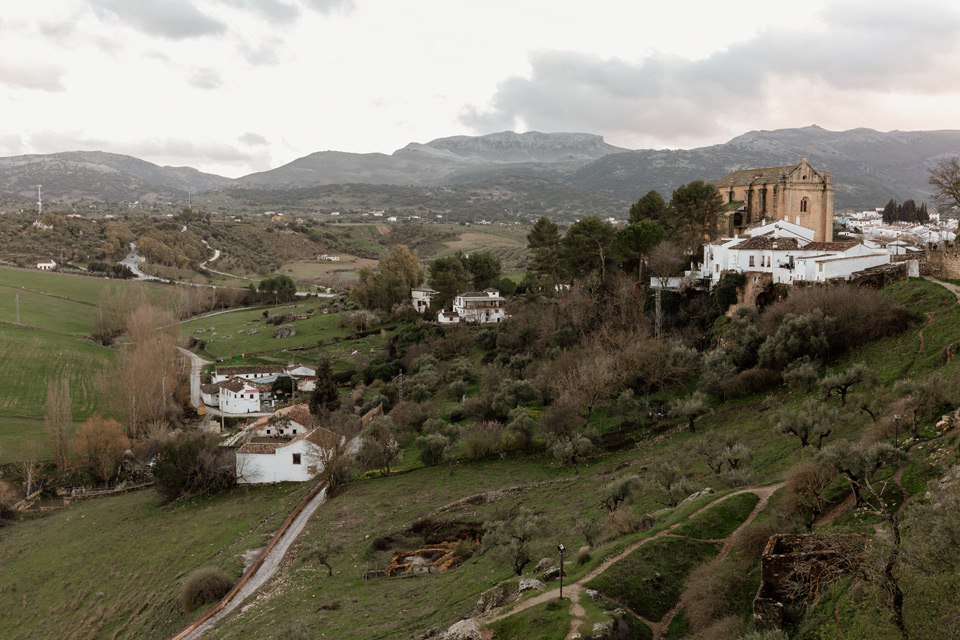
We pass through the small town of El Burgo.
Mirador del Guarda Forestal
The Mirador del Guarda Forestal viewpoint is not very interesting in my opinion. The path we were following was much cooler than the views from it. There were various shapes of stones and interesting trees at the path, which gave a nice atmosphere. However, I must admit that we didn’t have good visibility, so maybe on a sunny day this place will be perceived differently.
We get into the car and continue the journey to Ronda.
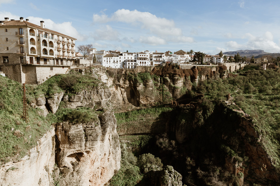
ronda – sightseeing plan
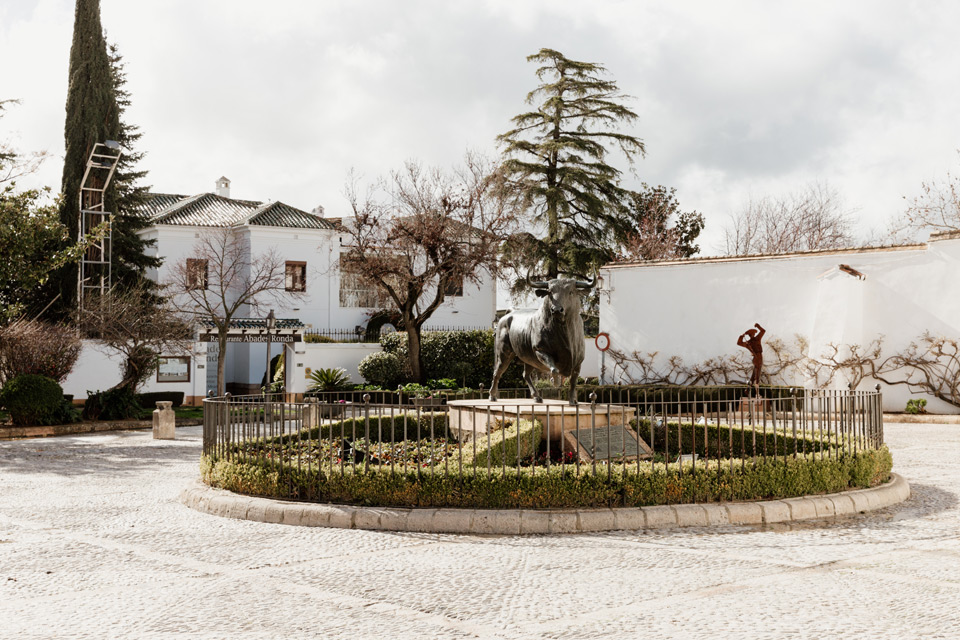
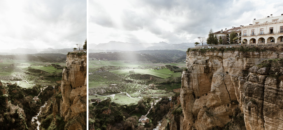
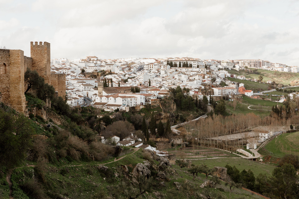
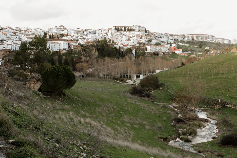
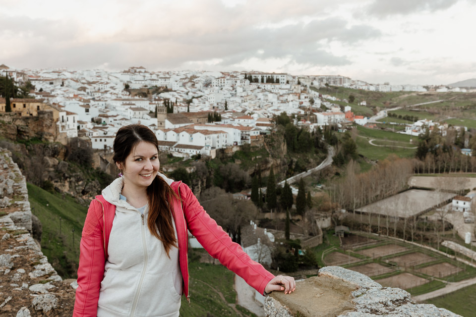
We arrive at Ronda after 4pm. We park in a free car park and go to pick up the keys to the apartment. Unfortunately, at the entrance we wait for the owner for about 25 minutes, so we leave the apartment for sightseeing only after 5pm. We have little time before sunset to go around Ronda on the route I made.
Map of our walk- part 1 (click here)
Map of our walk – part 2 (click here)
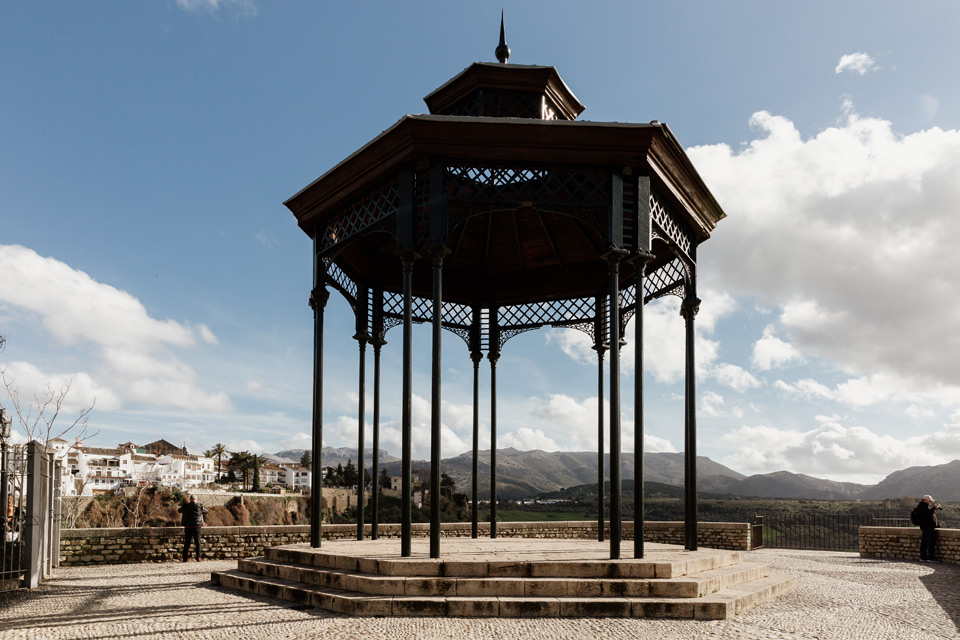
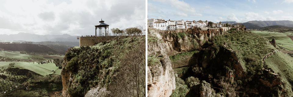
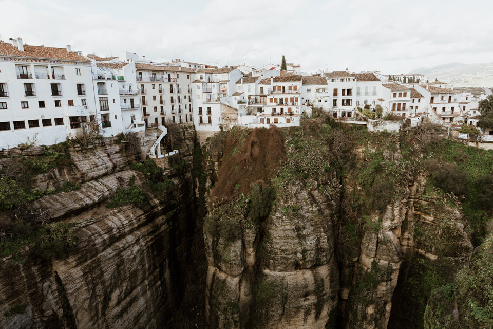
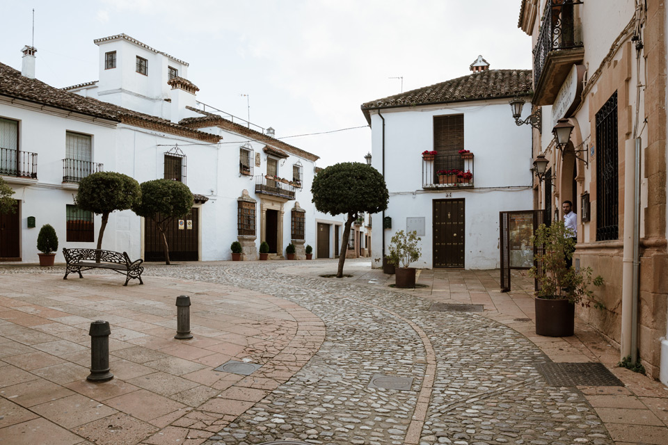
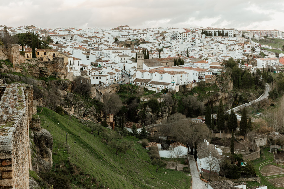
One of Ronda’s streets with many shops and restaurants is Carrera Espinel. At its end is the Bullfight Arena and Alameda del tajo – a viewing terrace from which we can see for the first time how beautiful Ronda is.
We can’t rave too long. We have little time and we are hungry. For this reason, we go for quick food to McDonalds on Plaza Espana next to the Puente Nuevo bridge. We order fries with cheese and bacon. Tasty, and unfortunately this is not available on the Polish menu.
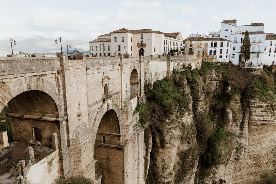
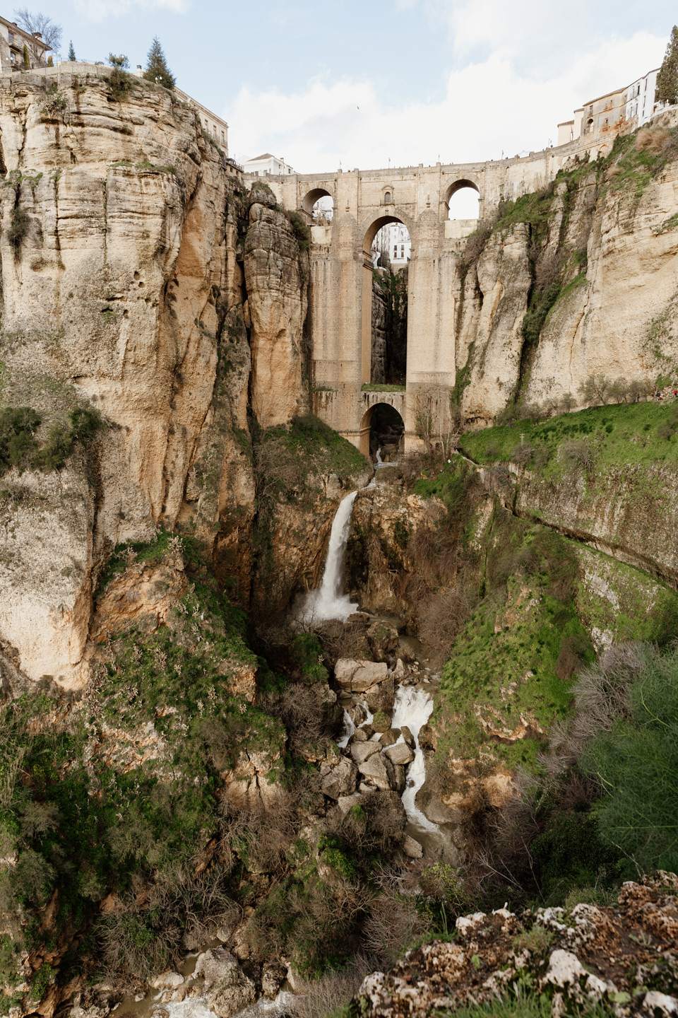
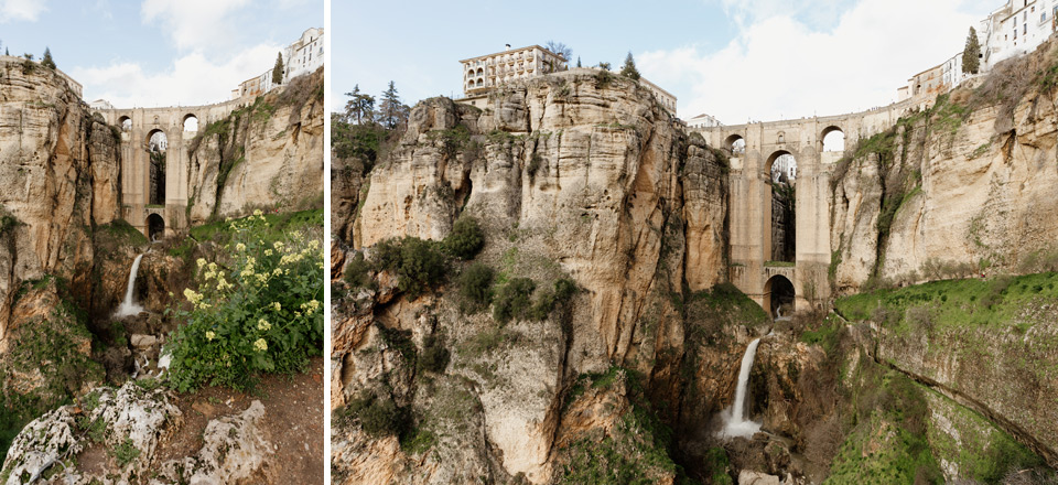
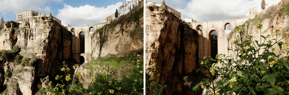
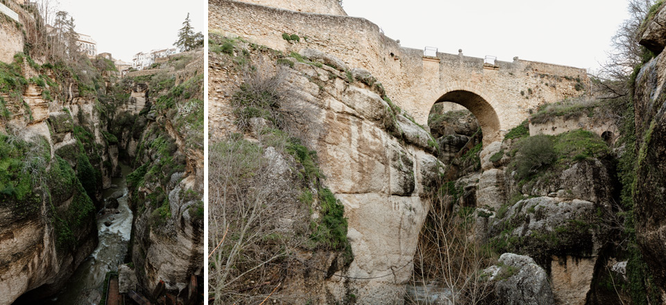
Puente Nuevo- the most beautiful ronda bridge
We enter the bridge, from which we admire the views that often occur on Andalusian postcards.
We continue the journey according to the maps I have placed above.

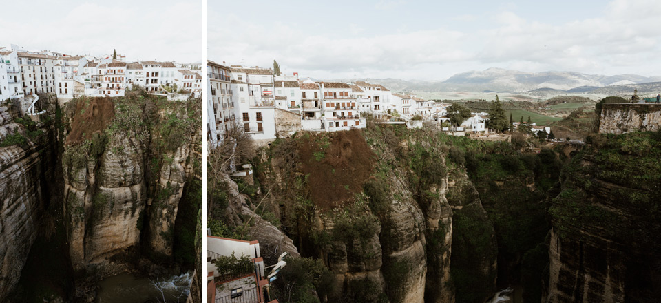
where to photograph Ronda’s postcard?
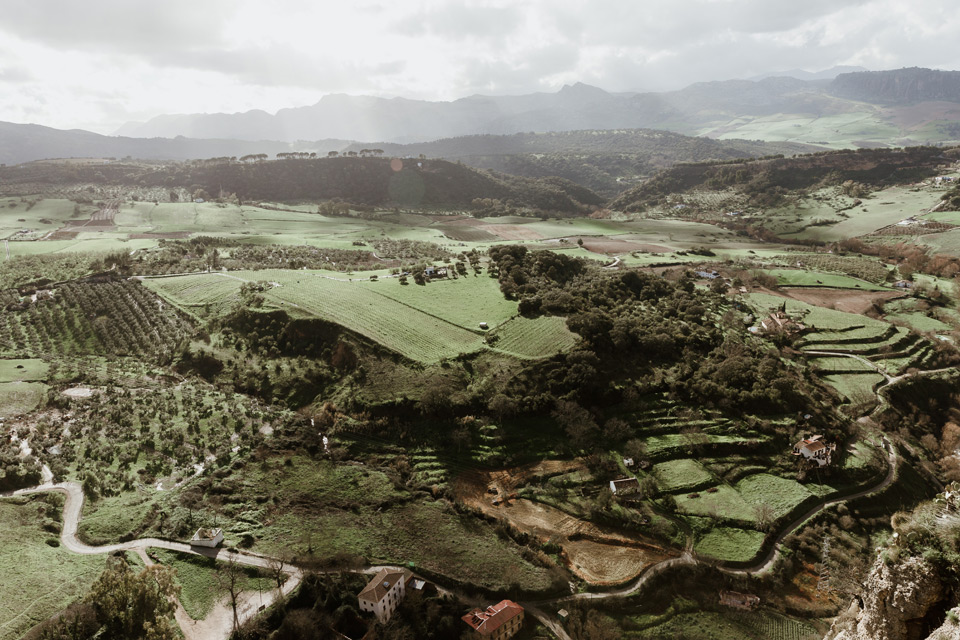
At Plaza de Maria Auxiliadora there is a descent onto a path that leads down. From there, you can see the Puente Nuevo bridge and the beautiful rocks surrounding it, and the small Guadaletin river.
What else is worth seeing in Rondo?
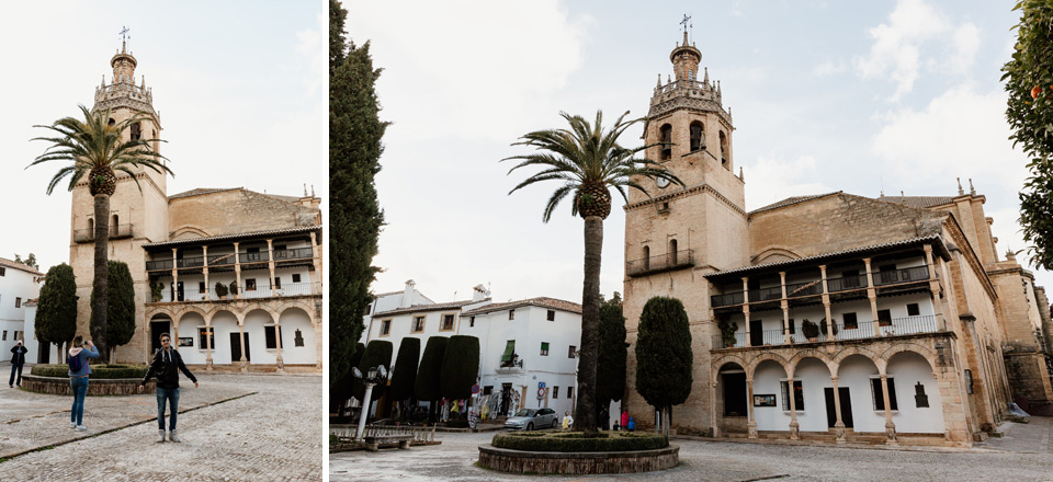
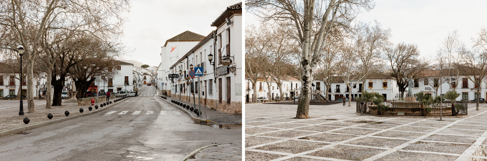
We go back up the same route and approach the Plaza Duquesa de Percent, where there are some interesting monuments.
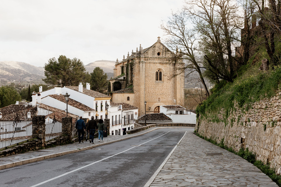
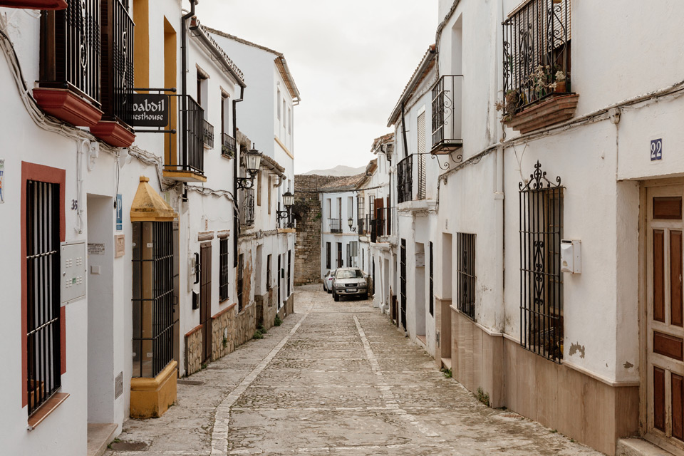
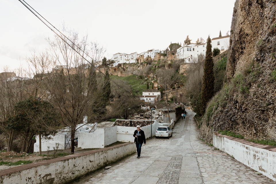
We walk to the south of Ronda along Calle Arminan. In front of us we can see the church of Espiritu Santo.
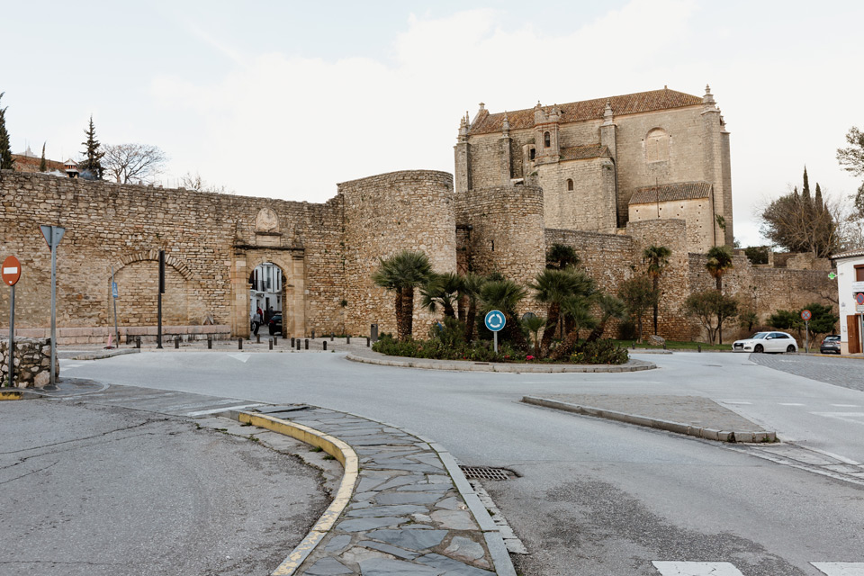
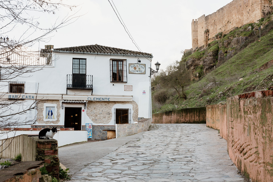
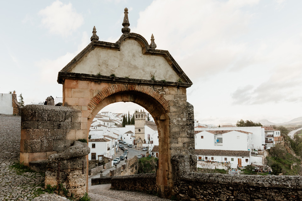
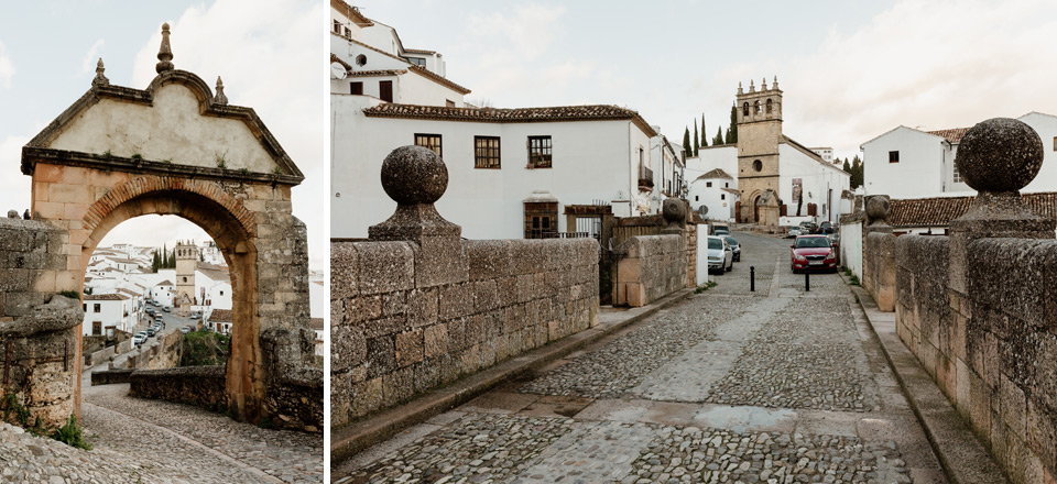
Puerta de Almocabar- gate to the old town

 We pass by the church, then through a small street we reach Puerta de Almocabar. We hang around the area, including the square opposite the gate.
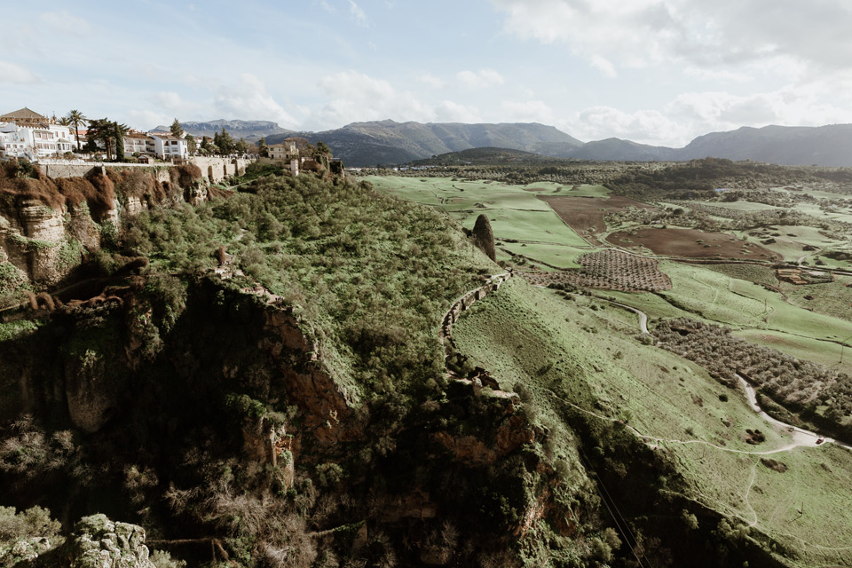
Calle Marbella- Great views of the Old Town
We open the second part of our map. We walk along the street Calle Marbella, from which we turn onto a small path, from which in the distance you can again see the Old Town. A river flows on the right. Dad laughs that I probably don’t like him and I lead the way down so that he will have to go up the hill again. And my sister, in turn, has taken a better shape since her last trip and chased us all away.
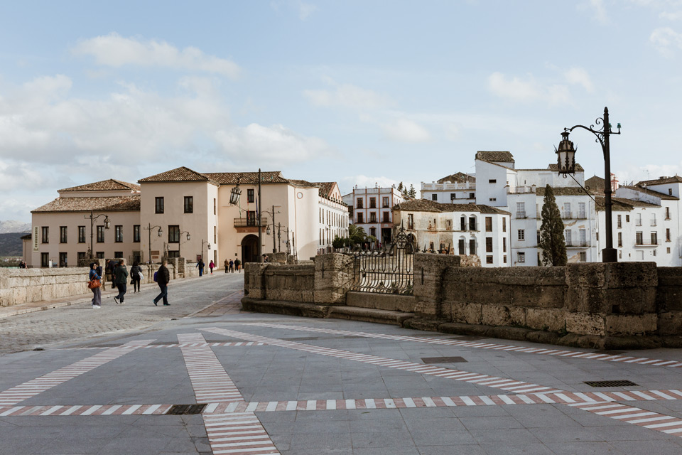
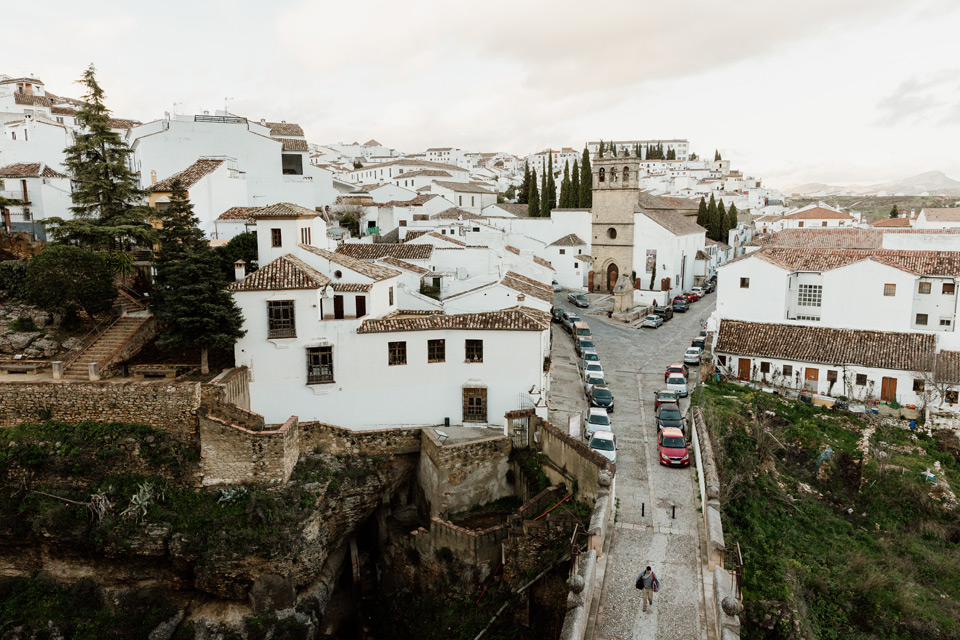
Second important bridge – Puente Viejo
We go a long way and finally reach the Puente San Miguel bridge. We can see the Puente Viejo bridge from here.

Unfortunately you have to go uphill …
Even more Ronda monuments
We approach the church, which was already visible from afar – Iglesia de Padre Jesus. A bit further we stop at the bridge, which we just saw from below – Puente Viejo. Even higher is the small gate through which we pass. We approach a piece and photograph the church again from a new, different perspective.
We walk a bit through the streets.
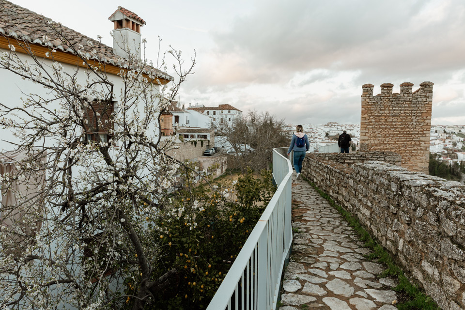
City defensive walls
We enter the city walls. It’s getting dark. Unfortunately the sky is overcast and the sunset is practically invisible.
In the end it got almost completely dark, so we decide to go back to the apartment. The apartment is very cold despite the heating on. Although the apartment was large, comfortable and very well equipped, I would never recommend it to anyone.
I regret that we had so little time in Ronda, but it’s important that we managed to bypass the most important points. I learned one interesting thing from my in-laws who once visited Andalusia, which I didn’t know about. Right by the Puente Nuevo bridge it’s possible to go down to the bridge and walk on small paths right next to the river itself. We would not have enough time for it anyway, but it’s definitely worth to diversify the trip in this way.
Thank you for reading the entry!
If you think it is interesting, we would be pleased if you leave a mark in the comment.
You will find more posts from Andalusia here:
There are direct links to the next and previous episodes below.
All our travels: Travels
We also invite you to our Instagram and Facebook fanpage, where you can be up to date with all our travels.
See you later! 🙂